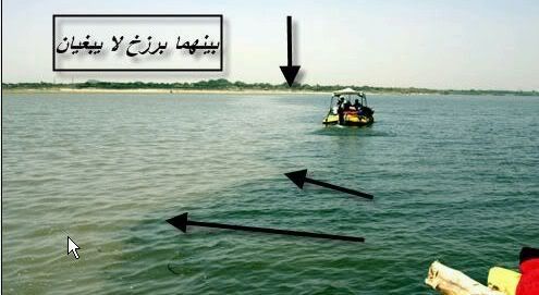
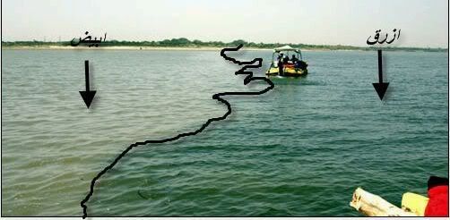
ALLAH'S MIRACLE RIVERS FOUND AS PER SURAH REHMAN, ALQURAN

furqanur

New Member
:salam2:

Yeterday I have received these two pictures of the rivers as a proof of Allah's message(s) through our beloved prophet as Quran in Surah Rehman.

These below pictures are belonging to the rivers from South Africa near to Cape Town . These two rvier's speciallity were discovered begeining on 20th century but Almighty God was already mentioned in the Holly Quran 1400 years back, for ref see (Surah Rehman). The speciality of these two rivers are that both are running in the same sea but the water taste are not same and they never mix each others (as per the order of Almighty God), one river's water taste is sour and other one is sweet. (Subhan Allah).


RIVERS-SURAHREHMANVERSESINQURAN.jpg

RIVER1A-SURAHREHMANQURAN.jpg

RIVER1B-SURAHREHMANQURAN.jpg
 

hijab_sister

ALLAH is in my heart
salam
wow.
MASHA ALLAH.
great.
jazakallahum khair bro for sharing.
i hop i will copy these pics n will send my frends through email.
INSHA ALLAH.
FI AMANILLAH
 

OsMaN_93

Here to help
mashallah
and heres another proof to show that islam truely was from Allah (Swt)
jazakom Allahu khairan
 

zedbj

Junior Member
:salam2:
About the same phenomena with Straits of Gibraltar.
::Quotation::
Inflow and outflow
Internal waves (marked with arrows) caused by the Strait of Gibraltar


On a net basis, water continually flows eastward into and through the Strait of Gibraltar, due to an evaporation rate within the Mediterranean basin higher than the combined inflow of all the rivers that empty into it. The sill of the Strait of Gibraltar acts to limit mixing between the cold, less saline Atlantic water and the warm Mediterranean waters. The latter are so much saltier that they sink below the constantly incoming Atlantic water and form a highly saline (thermohaline, both warm and salty) bottom water, called the Mediterranean outflow. A density boundary separates the layers at about 100 m depth. It flows out and down the continental slope, losing salinity, until it equilibrates after mixing at a depth of about 1000 meters. The Mediterranean outflow water can be traced for thousands of kilometers before losing its identity.

Internal waves (waves at the density boundary layer) are common in the strait. Like traffic merging on a highway, the water flow is constricted in both directions because it must pass over a shallow submarine barrier, the Camarinal Sill. When large tidal flows enter the Strait, internal waves are set off at the Camarinal Sill as the high tide relaxes. The waves—sometimes with heights up to 100 m—travel eastward. Even though the waves occur at great depth and the height of the waves at the surface is almost nothing, they can be traced in the sunglint because they concentrate the biological films on the water surface, creating slight differences in roughness. The waves flow eastward, refract around coastal features; can be traced for as much as 150 km, and sometimes create interference patterns with refracted waves.[7]

:: End QUOTATION::
http://en.wikipedia.org/wiki/Strait_of_Gibraltar
 

zedbj

Junior Member
:salam2:
About similar phenomena happened to Strait of Gibraltar:
1. http://www.lpi.usra.edu/publications/slidesets/humanimprints/slide_15.html

"High rates of evaporation in the relatively shallow Mediterranean basin cause the water to become saltier, and thereby denser, than the relatively fresh Atlantic water. As Atlantic water is forced through the narrow strait it accelerates and interacts with Mediterranean water. Internal waves (particularly those formed at depths of 60–80 meters) develop where these two different water masses interact. Large, tidally induced pulses of Atlantic water entering the Mediterranean can be seen here as a series of crescents emanating from the strait. These crescents result from interactions of these different water masses at depth."

2. http://pulson.seos.uvic.ca/gibralt.html

"Progress in Oceanography 1988,21 (1), 1-105
The Flow of Atlantic Water Through the Strait of Gibraltar
David M. Farmer1 & Laurence Armi2
The Flow of Mediterranean Water Through the Strait of Gibraltar
Laurence Armi2 & David Farmer1
Abstract:

We describe and analyze observations of the water exchange through the Strait of Gibraltar. The primary observations were taken in April 1986 and included data from moored recording instruments at four locations in the strait, together with an intensive survey by ship. These measurements included extensive CTD profiling, acoustic Doppler current profiling, numerous profiles from expendable instruments, and imaging using a high-frequency echo sounder.

The analysis focuses on the internal hydraulics of the Strait and in particular the presence of hydraulic controls and their influence on the exchange. Our observations during April 1986 show that the maximal exchange condition, in which a subcritical flow is bounded by supercritical flow at both ends of the Strait, did occur, although with various subtleties not explicitly incorporated in our previous theoretical developments.

The Atlantic water, moving east along the surface, encounters a control at Tarifa Narrows in the eastern part of the Strait. The Mediterranean water passes through controls both at Camarinal Sill and at Spartel Sill, further west. At our westernmost mooring at Spartel, the outflowing Mediterranean water is continuously supercritical, with little tidal variability. The control at Camarinal Sill is periodically lost due to tidal action and reappears on a reverse flow during a falling spring tide. Tangier Basin, bounded by Camarinal and Spartel Sills, acts as an internal reservoir for the outflowing Mediterranean water, the interface rising and falling through each tidal cycle. During spring tides, the Tangier Basin interface rises high enough to flood the control at Camarinal Sill and produces a reverse flow of the lower layer. When control is lost at Camarinal Sill a travelling bore is released. This bore may modify the location of the control acting on the surface layer in Tarifa Narrows. The Atlantic water enters the Alboran Sea as a jet which may have a well-defined northern boundary where it separates from the European coast; this boundary may be identified by the presence of a slick. Although the internal jump west of Camarinal Sill is almost certainly an area of intense mixing, frictional effects do not appear to be dominant in the subcritical portion of the flow."
 

danyal_1992

Junior Member
:salam2:
there is one in Pakistan too.Indus river and another(i dont know its name) they are running side by side but the arent mixing wid each other.They called that place "khund"

:wasalam:


:ma::ma::ma::ma::ma:
 

lukm4n

Junior Member
Is the 1st pic in this thread, the red sea?

I want to include this pic in my website but I need some info about it, unfortunately I don't understand arabic so can someone care to translate the commentary?
 
Top